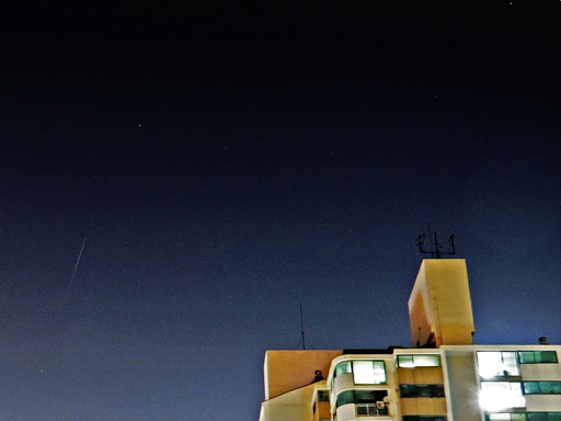
MetOp-A satellite flare
Posted by Wesley onLaunched in 2006, MetOp-A is the first European operational meteorological satellite, which is in a polar orbit. It currently serves as the backup of the MetOp-B that was launched in 2012. They also exhibit flares, although relatively less frequent and dimmer compared to the Iridium fleet.
This photo is a first for me in many aspects. It's the first time I did a long-exposure capture of a satellite flare. Previous ones were done in burst shots, then later animated and/or composited. It's also the first time that I used SX50 HS to capture a flare. iPhone 5S is better at burst shots, but not long exposure. Finally, this is the first non-Iridium flare that I caught in a photo.
The satellite moved downward in the northern sky, below the bright Polaris visible on the left side of the photo. If you click on the photo for a larger version, you can see most of the constellation Ursa Minor / Little Dipper covering the top part.
Considering the light pollution, this observation suggests that the satellite needs to be at least -1.0 magnitude at maximum, and be more than 30 degrees above horizon to make a noticeable streak in the photo. I guess that explains why I couldn't catch Tiangong-1 space station on photo several months ago.
Device: Canon SX50 HS
Settings: 45mm - ISO 200 - 15s - f/4.0
Filters: None
Time: 2014-04-08 21:26:38 KST
Location: Suwon, Korea
Max Magnitude: -2.2
Defined tags for this entry: astronomy, Canon SX50 HS, constellation, MetOp-A, satellite, star, Ursa Minor

