11th South Korean Degree Confluence
Posted by Wesley on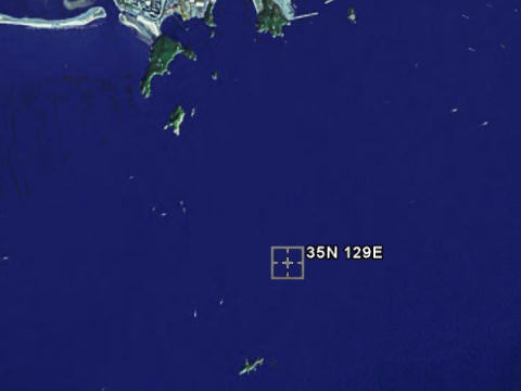
The 35N 129E degree confluence on Google Map.
Dadaepo area on the north and Namuseom on the south.
Image (C) 2005 DigitalGlobe.
Dadaepo area on the north and Namuseom on the south.
Image (C) 2005 DigitalGlobe.
It has been more than three years since my last South Korean confluence visit. I had completed visiting all 10 of the ground confluences here, so I had considered the mission largely complete. But about a year later the country page would list 13 additional water confluences that were classified as 'in the view of the land' and thus added to the primary confluences. Since then there were two foreigner-led attempts to visit these water confluences (one near Mokpo and one near Incheon), all without success.
While recreating my website I remembered these forgotten visits I made, added the link to confluence.org, and vowed to pick up where I left off. I had two points in mind: 37N 126E, and this one - 35N 129E. The 37N 126E one is one of the confluences that are relatively near Seoul and I was originally planning to go there first. However, I was going down to Ulsan to visit my family over the weekend and this brought me fairly close to 35N 129E which is right off the coast of Busan, the city just south of Ulsan. So I made change of plans and decided to try my luck at this one instead.
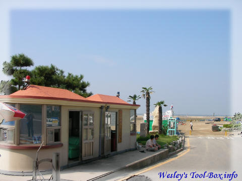
The Dadae 1-dong Young Men's Association
Dad drove down to Busan with my mom and I flew directly to Busan from Seoul and we met at the airport. Then we went to Dadaepo beach, which was the closest place on the peninsula from the confluence we were going to visit. A boat was needed to go to the actual coordinates, but we didn't know where to rent one, so I asked the folks at Dadae 1-dong Young Men's Association for information. They pointed me to the area with fishing stores nearby.
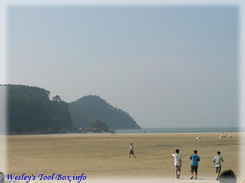
Dadaepo beach - closed for the season
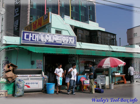
The fishing store
We went to the first fishing store on the block and they had transports to and from the nearby isles by boat. A lot of fishermen went to the isles to do fishing, so they had regular schedules for this. So we decided to ride on one of these to go near the confluence.
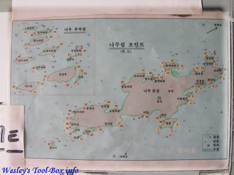
Map of Namuseom
Because they weren't exactly sure what isle the coordinates would be close to, we paid for the tickets to the trip that went a bit far, to Hyeongjeseom ('Brother Island'), which was about 3 nautical miles from Namuseom ('Tree Island'). Namuseom was about 3 nautical miles from the port.
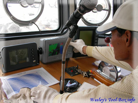
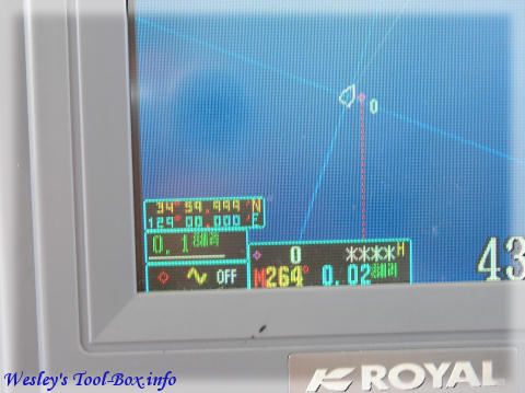
Captain adjusts GPS
We eventually rode on the boat, named 'Daeheung', and asked the captain (Mr. Hae-Yun Choi) to alter the route slightly so that the boat passes the confluence. He gladly accepted our request and input the coordinates to the ship's GPS.
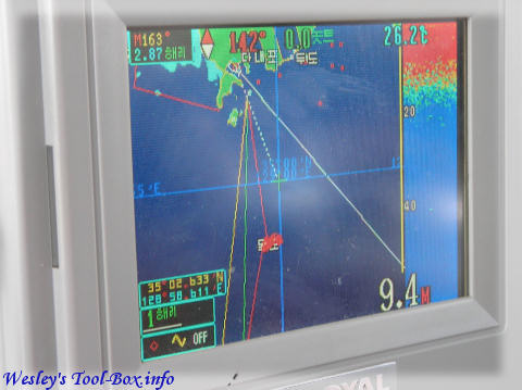
Calibrated GPS points to the degree confluence - Namuseom (displayed as Mokdo) appears slightly to the south
As it turns out it was located near the route to Namuseom, and we didn't need to go to Hyeongjeseom. The captain told us to get half the money back because we won't be going so far.
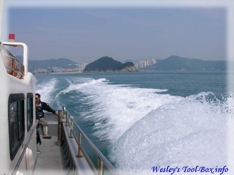
Away we go!
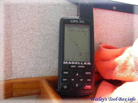
My GPS also kept track of the location
Right on the degree confluence
After about 10 minutes of going almost in a straight line, the boat finally stopped over the degree confluence of 35N 129E. We were excited. I was impressed that the captain was able to stop the boat dead in the water on the exact coordinates.
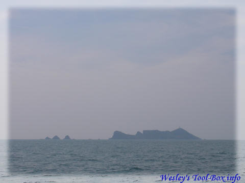
South: Namuseom
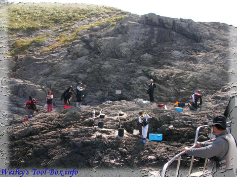
On the southern horizon, the boat's first destination, Namuseom, was clearly visible. It was about a kilometer away. We would eventually find quite a few fishermen around the island area alone.
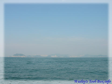
North: Dadaepo, Busan
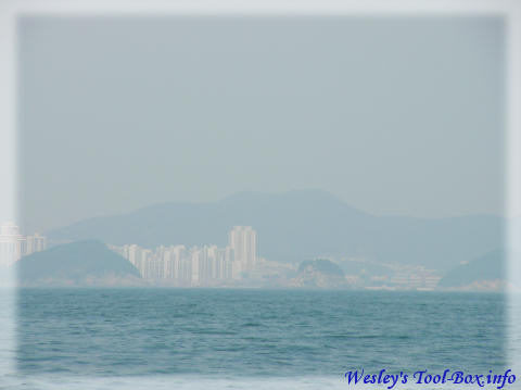
Closeup of the Dadaepo area
On the northern horizon, the Dadaepo port area, where the boat originated, was looming. This was apparently what confluence.org meant by 'visible land'. I could see a lot of apartment complexes.
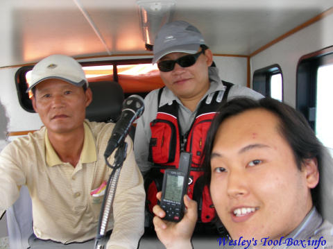
In the bridge (left to right): the captain, an interested fisherman, and me
On Namuseom
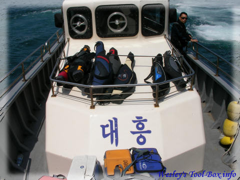
The boat that went to the degree confluence
After taking some commemorative photos the boat resumed its course and arrived at Namuseom. Unlike other fishermen, we had our mission accomplished, so we switched to the boat which would return to the port immediately.