On Apple Maps update of South Korea region
Posted by Wesley on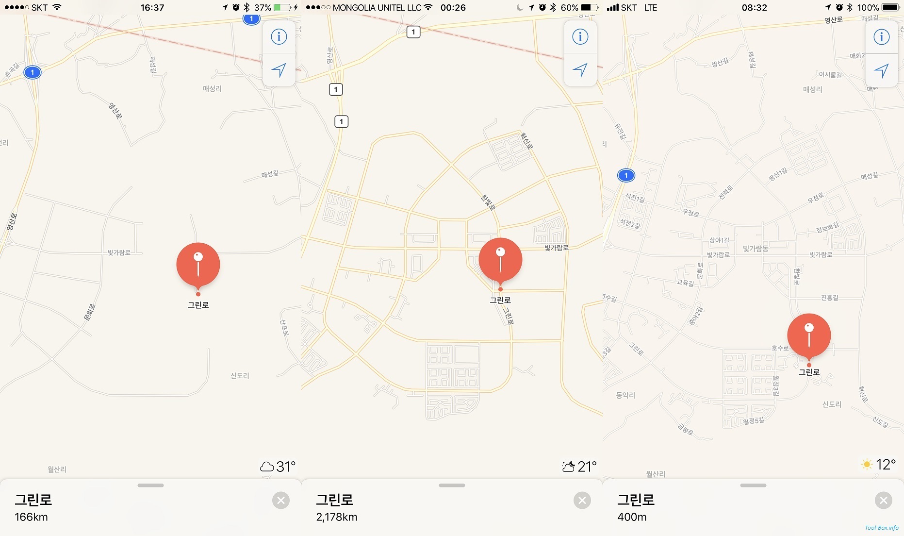
Apple Maps showing Naju Bitgaram City area - 2014, 2015, and 2017 edition (left to right, click to enlarge)
One of the sore spots in using an Apple device (iPhone, iPad, and Apple Watch in particular) in Korea was the Apple Maps. Sure, you could use the natively developed map apps from the likes of Kakao or Naver, but regular apps using map function generally resort to the default Apple Maps data, leading to sub-par experience.
This had largely to do with the lack of map updates. When Apple Maps initially launched in September 2012, map data for Korea was sparse at best. It then received a major update in March 2014 that looked more complete at a first glance. However, delving into details revealed that the actual map data was from around latter half of 2012. This was clearly evident for Bitgaram City as you can see above. Roads weren't completed until 2013, and Apple Maps had much of the major roads missing.
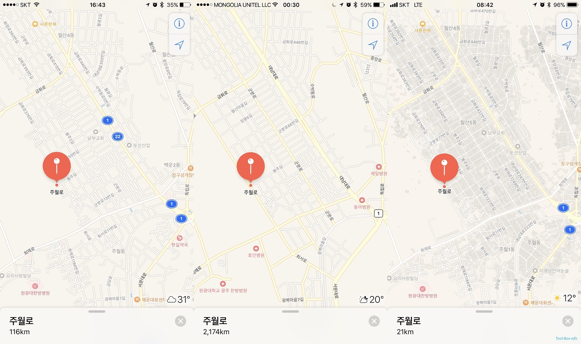
Apple Maps showing Gwangju's Juwol-dong area - 2014, 2015, and 2017 edition (left to right, click to enlarge)
Interestingly, there was another map update for Korea in April 2015. It showed all the major roads in Bitgaram City, as well the street of Juwol-ro in Gwangju that was completed in early 2015. This meant that the map was quite up to date at the time, but you could see it only if you were outside South Korea. The Korean server for the iOS Apple Maps that sends the data to users within the borders never received the update, leaving the Korean users with severely outdated map for several years. The screen caps shown here were made while I was on a trip to Mongolia a few months ago.
I actually asked Apple's technical support about this issue back in June. Sadly, no resolutions came out of this even though the staff did acknowledge the problem. Then, out of the blue, Apple Maps received yet another major update for South Korea yesterday afternoon. The new map data was fairly recent - judging from the building data, it seemed to be from early to mid 2017.
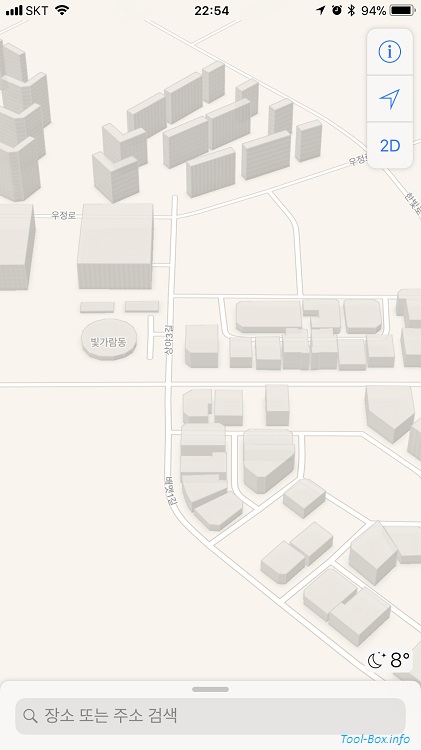
3D Map-enabled view of the eastern Bitgaram City
Speaking of which, yes, there were now outlines of most of the buildings. This didn't exist for South Korea before this update. The building data also contain height information, which enabled this nice flyover-style view of the map in 3D. With the updated road and building information, I felt that it finally became good enough for in-app uses, such as location-based arrangement of photos in the Photos app. With a few more feature additions and beefing up of POI data, it should be good enough for stand-alone uses as well.